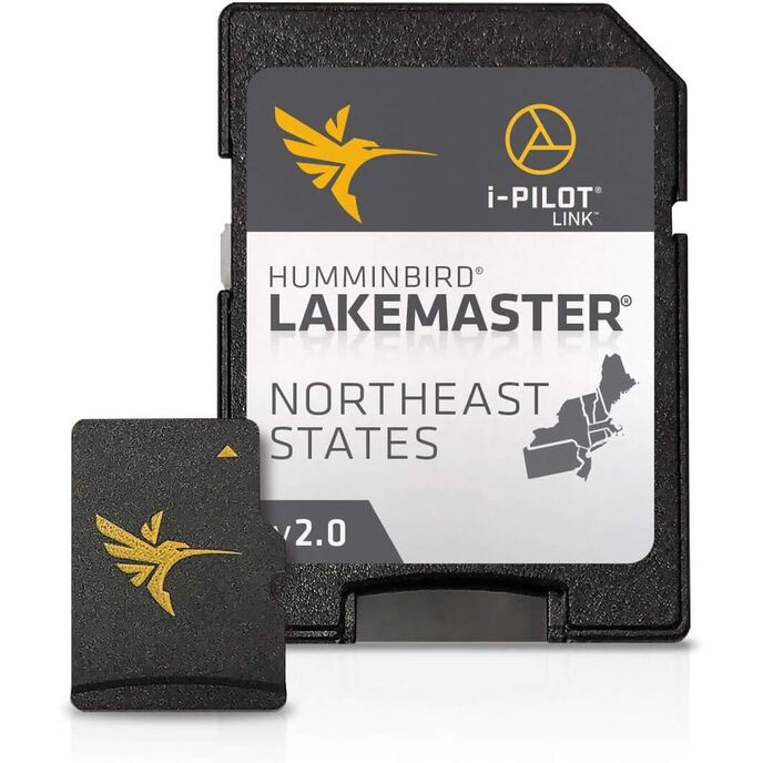
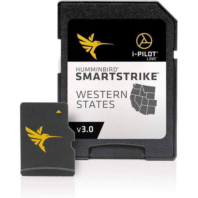
LakeMaster Plus digital maps come on a Micro SD card (with included SD card adapter) that's compatible with all GPS-equipped HELIX, SOLIX, ONIX, and ION Series models and select 600-1100 Series models. Easy-to-see shading highlights shallow-water areas within an adjustable range up to 30 feet, and depth contours and shorelines can be synchronized with the actual water levels of lakes, reservoirs, and rivers. LakeMaster Plus enables you to view an aerial image overlay on high-definition waters to see the entry and exits of creek channels, to see how far a reef or weed line extends, and to pick out shallow-water rock piles, steep drop-offs, and other features. This LakeMaster Plus Northeast States Edition, Version 2 boasts more than 130 high-definition lakes and over 1,700 total lakes from PA, NJ, NY, CT, MA, VT, NH, and ME, adding over 200 new lakes since the prior version (27 in high definition). Get an added angling advantage with LakeMaster Plus mapping, which adds high-quality aerial photography to its unrivaled accuracy and detail, easy-to-read contours, highlighted depth ranges, and scrollable lake lists.
EAN: 0082324050046
Categories Electronics, Car & Vehicle Electronics, Boat Electronics, Marine GPS Chartplotters,
| Brand | Humminbird |
| Brand Name | Humminbird |
| Color | Black |
| Color | Black |
| Compatible Devices | all GPS-equipped HELIX, SOLIX, ONIX, and ION, 600-1100 Series models |
| Customer Reviews | 4.3 4.3 out of 5 stars 85 ratings 4.3 out of 5 stars |
| Fishing Technique | Any |
| Included Components | Includes micro SD card with full size adapter and water resistant SD card carrying case. |
| Included Components | Includes micro SD card with full size adapter and water resistant SD card carrying case. |
| Item Dimensions LxWxH | 8 x 6 x 2 inches |
| Item Dimensions LxWxH | 8 x 6 x 2 inches |
| Item Package Dimensions L x W x H | 7.4 x 5.39 x 0.63 inches |
| Item Weight | 0.29 Pounds |
| Item Weight | 0.29 Pounds |
| Manufacturer | Humminbird |
| Map Type | North America |
| Material | Plastic |
| Model Name | LakeMaster PLUS |
| Model Name | LakeMaster PLUS |
| Number of Items | 1 |
| Package Weight | 0.16 Kilograms |
| Part Number | 600045-4 |
| Screen Size | 27 Inches |
| Size | LakeMaster Plus |
| Sport Type | Fishing |
| Sport Type | Fishing |
| Style | LakeMaster Plus |
| Suggested Users | Unisex-Adult |
| Warranty Description | 30-day manufacturer |

€ 1549.49
€ 1549.49